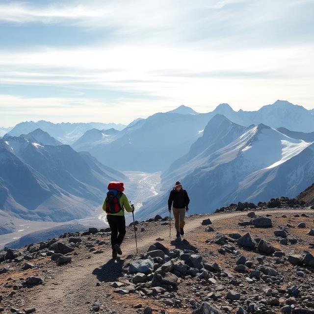
The Alps become a completely different world when winter arrives. Snow-covered peaks, frozen valleys, quiet forests and dramatic mountain scenery make the region one of the most spectacular places on Earth for a winter trekking adventure.
But the best snow treks in the Alps aren’t all the same. Some are relatively easy winter walks on maintained trails, while others venture into high-altitude terrain where snow, ice and avalanche conditions require specialist equipment and experience.
In this guide, we’ve organized some of the most memorable snowy treks by location, covering Switzerland, Austria, France, Italy and Slovenia. You’ll find options ranging from accessible winter hikes with spectacular views to more demanding alpine adventures.
Whether you’re looking for a snow trek near Zermatt, a winter hike in the Dolomites, a scenic route around Chamonix, or a snowy trail in the Austrian Alps, these destinations offer plenty of possibilities for your next mountain adventure.
Before setting out, always check current trail conditions, avalanche forecasts, weather and local guidance. Winter mountain conditions can change quickly, and a route that’s straightforward in summer may become significantly more challenging in snow.
Best Long-Distance Snowy Treks in the Swiss Alps
Via Alpina Switzerland — Liechtenstein to Montreux/Geneva, Switzerland

The Via Alpina Switzerland crosses the country from the eastern Alps toward the shores of Lake Geneva, passing through some of Switzerland’s most spectacular mountain landscapes. The route travels through traditional Alpine villages, high mountain passes, forests, meadows, and rugged valleys, showcasing the diversity of the Swiss Alps. Depending on the itinerary, trekkers pass through regions including Graubünden, Central Switzerland, the Bernese Oberland, and Valais. Its long distance and sustained elevation changes make it a major undertaking for experienced long-distance trekkers.
Quick Facts: Location: Swiss Alps, Switzerland | Difficulty: Difficult | Typical Duration: 15–25 days | Maximum Elevation: Approximately 9,000 ft (2,750 m) | Trek Type: Long-Distance Alpine Trek | Best Season: June–September
Starting Point: Liechtenstein border/Sargans area | Finish: Montreux or Geneva, depending on itinerary | Route: Eastern Switzerland → Central Alps → Bernese Oberland → Valais → Lake Geneva region.
Where to Stay: Cities/Places to Stay: Sargans, Glarus, Engelberg, Lauterbrunnen, Kandersteg, Adelboden, Leukerbad, Montreux. Trekkers typically stay in mountain huts, guesthouses, small hotels, and traditional Alpine villages along the route.
Swiss Alpine Pass Route — Sargans to Montreux

The Swiss Alpine Pass Route crosses Switzerland from Sargans in the east toward Montreux on Lake Geneva, linking numerous historic mountain passes. The trail moves through dramatic valleys, high meadows, forests, and rugged mountain terrain, with views of some of the country’s most impressive Alpine landscapes. Along the way, trekkers encounter traditional villages, mountain farms, and historic routes that have connected different parts of Switzerland for centuries. The combination of long distances, steep ascents, and high passes makes this a challenging multi-week trek.
Quick Facts: Location: Sargans to Montreux, Switzerland | Difficulty: Difficult | Typical Duration: 14–18 days | Maximum Elevation: Approximately 9,000 ft (2,750 m) | Trek Type: Long-Distance Mountain Trek | Best Season: July–September
Starting Point: Sargans | Finish: Montreux | Route: Sargans → Glarus region → Engelberg → Meiringen → Kandersteg → Leukerbad → Valais → Montreux.
Where to Stay: Cities/Places to Stay: Sargans, Engelberg, Meiringen, Kandersteg, Leukerbad, Martigny, Montreux. Accommodation ranges from mountain huts and guesthouses to hotels in larger towns along the route.
Walker’s Haute Route — Chamonix, France to Zermatt, Switzerland

The Walker’s Haute Route is a classic long-distance trek through the Western Alps, connecting Chamonix in France with Zermatt in Switzerland. The route crosses numerous high passes and valleys while passing beneath major peaks, glaciers, and dramatic mountain landscapes. The Swiss sections include spectacular areas of Valais, with traditional villages and high mountain scenery surrounding the trail. The trek requires strong fitness and mountain experience because of its sustained climbs, changing weather, and high-altitude terrain.
Quick Facts: Location: Chamonix, France to Zermatt, Switzerland | Difficulty: Difficult | Typical Duration: 10–14 days | Maximum Elevation: Approximately 9,500–10,000 ft (2,900–3,050 m) | Trek Type: High-Altitude Long-Distance Trek | Best Season: July–September
Starting Point: Chamonix, France | Finish: Zermatt, Switzerland | Route: Chamonix → Argentière → Swiss Valais → Verbier → Arolla → Grimentz → Zinal → St. Luc → Zermatt.
Where to Stay: Cities/Places to Stay: Chamonix, Verbier, Arolla, Grimentz, Zinal, St. Luc, Zermatt. Trekkers typically combine mountain huts, refuges, guesthouses, and hotels depending on the section.
Tour du Mont Blanc — Switzerland, France & Italy

The Tour du Mont Blanc is a famous circular trek around the Mont Blanc massif, crossing through France, Italy, and Switzerland. The route passes through spectacular Alpine valleys, mountain passes, forests, meadows, and villages while providing views of glaciers and major peaks. The Swiss section includes the Val Ferret area and picturesque mountain communities before the trail continues around the massif. With established hiking infrastructure and numerous accommodation options, it is a popular multi-country trek, although the daily climbs can still be demanding.
Quick Facts: Location: France, Italy & Switzerland | Difficulty: Moderate–Difficult | Typical Duration: 9–12 days | Maximum Elevation: Approximately 8,300 ft (2,530 m) | Trek Type: Multi-Country Alpine Circuit | Best Season: June–September
Starting Point: Les Houches/Chamonix, France | Finish: Les Houches/Chamonix, France | Route: Les Houches → Les Contamines → Courmayeur → Val Ferret → Champex → Trient → Chamonix.
Where to Stay: Cities/Places to Stay: Chamonix, Les Houches, Courmayeur, La Fouly, Champex, Trient, Les Contamines. Trekkers can choose between mountain refuges, auberges, guesthouses, and hotels along the circuit.
Tour du Monte Rosa — Switzerland & Italy

The Tour du Monte Rosa circles the Monte Rosa massif through Switzerland and Italy, combining high mountain scenery with traditional Alpine valleys and villages. The trek provides spectacular views of Monte Rosa and other major peaks while crossing several mountain passes between the two countries. Sections of the route travel through the Swiss Valais and the Italian Aosta and Piedmont regions, creating a diverse cross-border trekking experience. Its high passes, steep terrain, and occasional snow or glacier conditions make it best suited to experienced mountain hikers.
Quick Facts: Location: Valais, Switzerland & Aosta/Piedmont, Italy | Difficulty: Difficult | Typical Duration: 8–12 days | Maximum Elevation: Approximately 10,000 ft (3,050 m) | Trek Type: High-Altitude Alpine Circuit | Best Season: July–September
Starting Point: Zermatt, Switzerland or Saas-Fee, Switzerland | Finish: Zermatt or Saas-Fee, depending on itinerary | Route: Zermatt → Saas Valley → Italian Alps → Macugnaga → Alagna → Valle di Gressoney → Val d’Ayas → Zermatt.
Where to Stay: Cities/Places to Stay: Zermatt, Saas-Fee, Macugnaga, Alagna, Gressoney, Champoluc. Accommodation includes mountain huts, refuges, guesthouses, and hotels in the villages surrounding Monte Rosa.
Best Long-Distance Snowy Treks in the French Alps
GR5 Alpine Section — Lake Geneva to Nice, France

The GR5 Alpine Section crosses the French Alps from the shores of Lake Geneva toward the Mediterranean coast near Nice. The route passes through dramatic mountain valleys, high passes, alpine meadows, forests, and traditional mountain villages. Along the way, trekkers experience several major Alpine regions, including the Chablais, Vanoise, Queyras, and Mercantour. Its long distance, sustained elevation changes, and remote mountain sections make it a demanding adventure for experienced long-distance hikers.
Quick Facts: Location: Lake Geneva to Nice, France | Difficulty: Difficult | Typical Duration: 25–35 days | Maximum Elevation: Approximately 9,000 ft (2,750 m) | Trek Type: Long-Distance Alpine Trek | Best Season: June–September
Starting Point: Saint-Gingolph, Lake Geneva | Finish: Nice | Route: Saint-Gingolph → Chablais → Vanoise → Queyras → Mercantour → Nice.
Where to Stay: Cities/Places to Stay: Saint-Gingolph, Chamonix, Modane, Briançon, Abriès, Guillestre, Saint-Étienne-de-Tinée, Nice. Trekkers typically stay in mountain refuges, gîtes, guesthouses, and hotels in villages along the route.
Tour des Écrins — Écrins National Park, France

The Tour des Écrins circles the spectacular Écrins National Park, one of the major protected mountain regions in the French Alps. The route passes through deep valleys, alpine meadows, rocky mountain passes, and remote villages beneath dramatic peaks and glaciers. Trekkers encounter a mixture of rugged high-altitude terrain and quieter valley trails, creating varied scenery throughout the circuit. The route’s elevation changes and mountain conditions make it best suited to hikers with good fitness and Alpine trekking experience.
Quick Facts: Location: Écrins National Park, France | Difficulty: Difficult | Typical Duration: 10–12 days | Maximum Elevation: Approximately 9,000 ft (2,750 m) | Trek Type: Alpine Circuit | Best Season: June–September
Starting Point: L’Argentière-la-Bessée or nearby Écrins villages | Finish: Same area | Route: Écrins valley → Vallouise → La Chapelle-en-Valgaudemar → Valgaudemar → Champsaur → Freissinières → Écrins valley.
Where to Stay: Cities/Places to Stay: Briançon, L’Argentière-la-Bessée, Vallouise, La Chapelle-en-Valgaudemar, Le Bourg-d’Oisans, Saint-Christophe-en-Oisans. Accommodation includes mountain refuges, gîtes, guesthouses, and small hotels.
Tour du Queyras (GR58) — Queyras, France

The Tour du Queyras, also known as the GR58, circles the spectacular Queyras Regional Natural Park in the southeastern French Alps. The trail travels through sunny alpine valleys, high passes, forests, flower-filled meadows, and traditional stone villages. The route is known for its relatively remote setting and distinctive landscapes near the French-Italian border. With numerous mountain refuges and villages along the way, it provides a well-established multi-day trekking experience.
Quick Facts: Location: Queyras, France | Difficulty: Moderate–Difficult | Typical Duration: 7–10 days | Maximum Elevation: Approximately 9,000 ft (2,750 m) | Trek Type: Alpine Circuit | Best Season: June–September
Starting Point: Ceillac or another Queyras village | Finish: Same area | Route: Ceillac → Saint-Véran → Agnièle → Abriès → Aiguilles → Arvieux → Ceillac.
Where to Stay: Cities/Places to Stay: Ceillac, Saint-Véran, Abriès, Aiguilles, Arvieux, Guillestre. Trekkers can stay in mountain refuges, gîtes, guesthouses, and small hotels throughout the Queyras villages.
Tour de la Vanoise — Vanoise National Park, France

The Tour de la Vanoise explores the rugged landscapes of Vanoise National Park in the heart of the French Alps. The route passes beneath glaciers and high peaks while crossing alpine meadows, forests, rocky passes, and traditional mountain valleys. Trekkers can experience dramatic scenery around Pralognan-la-Vanoise, the Tarentaise, and Maurienne regions. The combination of high mountain terrain and established refuge networks makes this a classic French Alpine circuit.
Quick Facts: Location: Vanoise National Park, France | Difficulty: Moderate–Difficult | Typical Duration: 7–10 days | Maximum Elevation: Approximately 9,500 ft (2,900 m) | Trek Type: High-Alpine Circuit | Best Season: July–September
Starting Point: Pralognan-la-Vanoise or another Vanoise village | Finish: Same area | Route: Pralognan-la-Vanoise → Refuge de la Vanoise → Termignon → Aussois → Modane → Vanoise valleys → Pralognan.
Where to Stay: Cities/Places to Stay: Pralognan-la-Vanoise, Bozel, Pralognan, Termignon, Aussois, Modane. Accommodation includes mountain refuges, gîtes, guesthouses, and hotels in the surrounding villages.
Tour du Beaufortain — Beaufortain, France

The Tour du Beaufortain circles the beautiful Beaufortain massif near Mont Blanc, combining dramatic mountain scenery with traditional Alpine villages and pastoral landscapes. The trail crosses green meadows, forests, ridges, and mountain passes with views toward Mont Blanc and surrounding peaks. Along the route, hikers pass working mountain farms and landscapes famous for Beaufort cheese production. Its moderate distance and extensive network of refuges make it a popular multi-day trek in the French Alps.
Quick Facts: Location: Beaufortain, France | Difficulty: Moderate–Difficult | Typical Duration: 5–8 days | Maximum Elevation: Approximately 8,500 ft (2,600 m) | Trek Type: Alpine Circuit | Best Season: June–September
Starting Point: Les Contamines-Montjoie or Queige/Beaufort area | Finish: Same area | Route: Beaufort → Arêches → Col du Joly → Les Contamines → Col de la Croix du Bonhomme → Beaufortain → Beaufort.
Where to Stay: Cities/Places to Stay: Beaufort, Arêches-Beaufort, Les Contamines-Montjoie, Hauteluce, Queige, Bourg-Saint-Maurice. Trekkers can choose from mountain refuges, gîtes, guesthouses, and Alpine hotels in the surrounding villages.
Best Snowy Treks Italian Alps & Dolomites
Alta Via 2 — Dolomites, Italy

The Alta Via 2 crosses the dramatic Dolomite mountains from north to south, passing through rugged limestone landscapes, high mountain passes, alpine meadows, and narrow valleys. The route is known for its spectacular rock formations, including towering pinnacles, cliffs, and jagged peaks. Several sections involve steep terrain, exposed paths, and challenging mountain conditions, making it more demanding than many other Dolomite routes. Mountain rifugi along the way allow trekkers to experience the Dolomites over an extended hut-to-hut journey.
Quick Facts: Location: Dolomites, Italy | Difficulty: Difficult | Typical Duration: 10–14 days | Maximum Elevation: Approximately 10,000 ft (3,050 m) | Trek Type: High-Alpine Hut-to-Hut Trek | Best Season: July–September
Starting Point: Bressanone (Brixen) | Finish: Feltre | Route: Bressanone → Plose → Odle → Puez → Sella → Marmolada → Pale di San Martino → Feltre.
Where to Stay: Cities/Places to Stay: Bressanone, Canazei, Arabba, Agordo, Falcade, Feltre. Most nights are spent in mountain rifugi, with hotels and guesthouses available in the valley towns before or after the trek.
Alta Via 9 — Dolomites, Italy

The Alta Via 9 traverses some of the eastern Dolomites, combining dramatic limestone peaks with forests, alpine meadows, and remote mountain valleys. The route provides a quieter alternative to some of the more heavily traveled Dolomite trails while still offering spectacular mountain scenery. Trekkers encounter rugged terrain, high passes, and traditional mountain settlements along the journey. Its length and elevation changes make it best suited to hikers with good mountain fitness and experience.
Quick Facts: Location: Dolomites, Italy | Difficulty: Difficult | Typical Duration: 9–12 days | Maximum Elevation: Approximately 9,000 ft (2,750 m) | Trek Type: Long-Distance Alpine Trek | Best Season: July–September
Starting Point: Bolzano area | Finish: Cortina d’Ampezzo or eastern Dolomites, depending on itinerary | Route: Bolzano → Dolomite valleys → high mountain passes → eastern Dolomites → Cortina area.
Where to Stay: Cities/Places to Stay: Bolzano, San Candido, Cortina d’Ampezzo, Auronzo di Cadore, Pieve di Cadore. Accommodation includes mountain rifugi, guesthouses, and hotels in the surrounding Dolomite towns.
Alta Via 1 — Lago di Braies to Belluno, Italy

The Alta Via 1 is one of the most famous long-distance trekking routes in the Dolomites, running from Lago di Braies toward Belluno. The trail passes through spectacular limestone formations, alpine meadows, forests, and high mountain passes beneath iconic Dolomite peaks. Trekkers stay in mountain rifugi, creating a classic hut-to-hut experience with relatively straightforward logistics. The route combines dramatic scenery with established trails and is suitable for experienced hikers comfortable with sustained mountain climbs.
Quick Facts: Location: Lago di Braies to Belluno, Italy | Difficulty: Moderate–Difficult | Typical Duration: 8–11 days | Maximum Elevation: Approximately 9,000 ft (2,750 m) | Trek Type: Hut-to-Hut Alpine Trek | Best Season: July–September
Starting Point: Lago di Braies | Finish: Belluno area | Route: Lago di Braies → Fanes → Lagazuoi → Cinque Torri → Pelmo → Civetta → Belluno.
Where to Stay: Cities/Places to Stay: Dobbiaco, Cortina d’Ampezzo, Alleghe, Agordo, Belluno. Most nights are spent in mountain rifugi, while these towns provide hotels, guesthouses, restaurants, and transportation connections.
Tour of the Gran Paradiso — Gran Paradiso, Italy

The Tour of the Gran Paradiso explores the valleys surrounding Gran Paradiso National Park in the Italian Alps. The route passes through alpine forests, flower-filled meadows, rocky valleys, and high mountain passes beneath glaciers and rugged peaks. The trek offers a combination of remote mountain scenery and traditional villages in the Aosta Valley and Piedmont regions. Depending on the chosen itinerary, hikers can experience some of the highest and wildest landscapes in northwestern Italy.
Quick Facts: Location: Gran Paradiso National Park, Italy | Difficulty: Moderate–Difficult | Typical Duration: 5–8 days | Maximum Elevation: Approximately 10,000 ft (3,050 m) | Trek Type: Alpine Circuit | Best Season: June–September
Starting Point: Cogne, Locana, or another Gran Paradiso valley village | Finish: Same area or a nearby valley | Route: Cogne → Valnontey → Valsavarenche → Rhêmes Valley → Noasca/Locana → Gran Paradiso valleys.
Where to Stay: Cities/Places to Stay: Cogne, Valsavarenche, Rhêmes-Notre-Dame, Locana, Aosta. Accommodation includes mountain refuges, Alpine lodges, guesthouses, and hotels in the surrounding valleys.
Tour of Monte Rosa Italian/Swiss Circuit — Aosta Valley & Valais

The Tour of Monte Rosa circles the massive Monte Rosa range across northern Italy and Switzerland, linking the Aosta Valley with the Swiss Valais. The route combines high mountain passes, glaciers, traditional Alpine villages, and spectacular views of Monte Rosa and surrounding peaks. Trekkers cross the international border several times while traveling through distinctive Italian and Swiss mountain landscapes. The high elevations and demanding terrain make it a challenging route for experienced Alpine hikers.
Quick Facts: Location: Aosta Valley, Italy & Valais, Switzerland | Difficulty: Difficult | Typical Duration: 9–12 days | Maximum Elevation: Approximately 10,000 ft (3,050 m) | Trek Type: High-Altitude Alpine Circuit | Best Season: July–September
Starting Point: Macugnaga, Italy or Zermatt, Switzerland | Finish: Same area, depending on itinerary | Route: Macugnaga → Alagna → Gressoney → Champoluc → Cervinia → Zermatt → Saas Valley → Monte Rosa region.
Where to Stay: Cities/Places to Stay: Macugnaga, Alagna, Gressoney, Champoluc, Breuil-Cervinia, Zermatt, Saas-Fee. Trekkers typically stay in mountain refuges and guesthouses, with hotels available in the larger resort towns.
Via Alta Vallemaggia — Ticino, Switzerland/Italian Alps Region

The Via Alta Vallemaggia crosses the remote mountain landscapes of Ticino in southern Switzerland, close to the Italian Alps. The route follows rugged ridges and high valleys with dramatic views over Vallemaggia, alpine lakes, forests, and surrounding peaks. It is known for its wild character, with long stretches of mountain terrain far from major settlements and roads. The demanding terrain and remote mountain huts make it particularly suitable for experienced hikers seeking a less-developed Alpine trekking experience.
Quick Facts: Location: Vallemaggia, Ticino, Switzerland | Difficulty: Difficult | Typical Duration: 8–12 days | Maximum Elevation: Approximately 9,000 ft (2,750 m) | Trek Type: Remote High-Alpine Traverse | Best Season: July–September
Starting Point: Locarno/Vallemaggia area | Finish: Fusio or another Vallemaggia village, depending on itinerary | Route: Vallemaggia → high Alpine valleys → mountain passes → Bavona/Bedretto region → Fusio.
Where to Stay: Cities/Places to Stay: Locarno, Cevio, Bignasco, Fusio, Bosco/Gurin. Trekkers generally use remote mountain huts along the route, while the valley towns provide hotels, guesthouses, restaurants, and transportation connections.
Best Long Distance Snowy Treks in the Austrian Alps
Adlerweg (Eagle Walk) — Tirol, Austria

The Adlerweg, or Eagle Walk, is a spectacular long-distance hiking route that traverses the Austrian state of Tirol from east to west. The route passes through dramatic limestone mountains, green alpine meadows, dense forests, deep valleys, and traditional mountain villages. Its extensive network of stages allows hikers to complete shorter sections or undertake a much longer journey across Tirol. With steep ascents, high passes, and varied mountain terrain, the route is particularly suited to experienced Alpine trekkers.
Quick Facts: Location: Tirol, Austria | Difficulty: Moderate–Difficult | Typical Duration: 20–30 days | Maximum Elevation: Approximately 9,000 ft (2,750 m) | Trek Type: Long-Distance Alpine Trek | Best Season: June–September
Starting Point: St. Johann in Tirol | Finish: St. Christoph am Arlberg | Route: St. Johann → Kaiser Mountains → Karwendel → Tux Alps → Zillertal → Ötztal → Arlberg.
Where to Stay: Cities/Places to Stay: St. Johann in Tirol, Kufstein, Innsbruck, Mayrhofen, Imst, Landeck, St. Anton am Arlberg. Trekkers can stay in mountain huts along the route, with hotels, guesthouses, and restaurants available in the larger Alpine towns.
Via Alpina Red Trail — Austrian Section

The Austrian section of the Via Alpina Red Trail crosses a vast range of landscapes throughout the Austrian Alps. The route passes through forests, alpine meadows, rugged valleys, mountain passes, and traditional villages while connecting several major Alpine regions. Because the Austrian section is extremely long, hikers can choose individual stages or combine multiple sections into a longer adventure. The route offers a broad experience of Austria’s diverse mountain scenery and traditional Alpine culture.
Quick Facts: Location: Austrian Alps, Austria | Difficulty: Moderate–Difficult | Typical Duration: 20–40+ days, depending on itinerary | Maximum Elevation: Approximately 9,500 ft (2,900 m) | Trek Type: Long-Distance Alpine Trek | Best Season: June–September
Starting Point: Eastern Austrian Alps | Finish: Western Austrian Alps | Route: Eastern Alps → Styria → Salzburg region → Tirol → Vorarlberg → western Alpine border.
Where to Stay: Cities/Places to Stay: Mariazell, Schladming, Bad Gastein, Innsbruck, Landeck, Bludenz, Bregenz. Accommodation includes mountain huts, farm stays, guesthouses, and hotels in Alpine towns.
E5 Alpine Crossing — Oberstdorf, Germany to Meran, Italy

The E5 Alpine Crossing is a classic trans-Alpine trek connecting Oberstdorf in Germany with Meran in northern Italy. The route crosses the Austrian Alps through mountain valleys, high passes, rocky terrain, alpine meadows, and traditional villages. As the trail progresses southward, the scenery gradually changes from the rugged Northern Alps to the warmer landscapes of South Tyrol. Established mountain huts and village accommodations make it possible to complete the crossing as a multi-day trek.
Quick Facts: Location: Oberstdorf, Germany to Meran, Italy | Difficulty: Moderate–Difficult | Typical Duration: 5–8 days | Maximum Elevation: Approximately 9,000 ft (2,750 m) | Trek Type: Trans-Alpine Crossing | Best Season: June–September
Starting Point: Oberstdorf, Germany | Finish: Meran, Italy | Route: Oberstdorf → Lech Valley → Zams → Pitztal/Ötztal → Timmelsjoch → Meran.
Where to Stay: Cities/Places to Stay: Oberstdorf, Holzgau, Zams, Zwieselstein, Vent, Meran. Trekkers typically stay in mountain huts and guesthouses, with hotels available in the larger towns.
Lechweg — Vorarlberg/Tirol, Austria

The Lechweg follows the Lech River from its source near Lake Formarinsee through the spectacular Lech Valley toward Füssen in Germany. The trail combines river landscapes, alpine meadows, forests, waterfalls, traditional villages, and rugged limestone mountains. Much of the route follows lower valley terrain rather than extremely high mountain passes, making it more accessible than many major Alpine treks. Its combination of natural scenery and picturesque villages makes it a popular long-distance walking route in western Austria.
Quick Facts: Location: Vorarlberg & Tirol, Austria | Difficulty: Moderate | Typical Duration: 6–8 days | Maximum Elevation: Approximately 6,500 ft (2,000 m) | Trek Type: Long-Distance Valley Trek | Best Season: June–October
Starting Point: Lake Formarinsee near Lech am Arlberg | Finish: Füssen, Germany | Route: Formarinsee → Lech am Arlberg → Warth → Steeg → Elbigenalp → Reutte → Füssen.
Where to Stay: Cities/Places to Stay: Lech am Arlberg, Warth, Steeg, Elbigenalp, Reutte, Füssen. Accommodation includes hotels, guesthouses, traditional inns, and mountain lodges along the Lech Valley.
Karnischer Höhenweg (Carnic High Route) — Carinthia/Tyrol

The Karnischer Höhenweg follows the high ridgeline of the Carnic Alps along the Austrian-Italian border. The trail travels through rugged limestone mountains, alpine meadows, rocky passes, and historic landscapes associated with the World War I mountain front. Hikers can enjoy expansive views across Austria and Italy while moving between remote mountain huts and valleys. The combination of steep terrain, exposed ridges, and historical sites makes this a challenging and distinctive Alpine trekking experience.
Quick Facts: Location: Carinthia & Tyrol, Austria | Difficulty: Difficult | Typical Duration: 8–12 days | Maximum Elevation: Approximately 8,500 ft (2,600 m) | Trek Type: High-Alpine Ridge Traverse | Best Season: July–September
Starting Point: Sillian | Finish: Arnoldstein | Route: Sillian → Carnic Alps → Kartitsch → Obertilliach → Kötschach-Mauthen → Plöckenpass → Nassfeld → Arnoldstein.
Where to Stay: Cities/Places to Stay: Sillian, Kartitsch, Obertilliach, Kötschach-Mauthen, Hermagor, Arnoldstein. Trekkers generally stay in mountain huts along the ridge, with guesthouses, inns, and hotels available in nearby valley towns.
Best Snowy Treks German Alps
Maximiliansweg — Lake Constance to Berchtesgaden, Bavaria

The Maximiliansweg is a classic long-distance trail crossing the Bavarian Alps from the Lake Constance region toward Berchtesgaden in southeastern Germany. The route passes through alpine meadows, forests, mountain valleys, rocky ridges, and traditional Bavarian villages, with views of numerous peaks along the way. Trekkers experience several distinct Alpine landscapes as the trail travels eastward across Bavaria. Its length, elevation changes, and mountainous terrain make it a demanding multi-day trek for experienced hikers.
Quick Facts: Location: Lake Constance to Berchtesgaden, Bavaria, Germany | Difficulty: Difficult | Typical Duration: 15–20 days | Maximum Elevation: Approximately 7,500 ft (2,300 m) | Trek Type: Long-Distance Alpine Trek | Best Season: June–September
Starting Point: Lindau/Lake Constance | Finish: Berchtesgaden | Route: Lindau → Oberstaufen → Füssen → Oberammergau → Lenggries → Tegernsee → Chiemgau → Berchtesgaden.
Where to Stay: Cities/Places to Stay: Lindau, Oberstaufen, Füssen, Oberammergau, Lenggries, Tegernsee, Reit im Winkl, Berchtesgaden. Trekkers can stay in mountain huts, guesthouses, traditional Bavarian inns, and hotels along the route.
Via Alpina German Section — Bavarian Alps, Germany

The German section of the Via Alpina crosses the Bavarian Alps through a network of trails connecting the region’s major mountain landscapes and traditional villages. The route passes through forests, alpine meadows, limestone mountains, valleys, and historic settlements, offering a varied experience of southern Germany. Sections of the trail travel close to the Austrian border and provide views toward prominent Alpine peaks. Because of its extensive distance, hikers can complete selected sections or combine stages for a longer Alpine journey.
Quick Facts: Location: Bavarian Alps, Germany | Difficulty: Moderate–Difficult | Typical Duration: 15–25+ days, depending on itinerary | Maximum Elevation: Approximately 8,000 ft (2,450 m) | Trek Type: Long-Distance Alpine Trek | Best Season: June–September
Starting Point: Lindau/Lake Constance region | Finish: Berchtesgaden region | Route: Lake Constance → Allgäu Alps → Ammergau Alps → Bavarian Prealps → Chiemgau Alps → Berchtesgaden.
Where to Stay: Cities/Places to Stay: Lindau, Oberstdorf, Füssen, Garmisch-Partenkirchen, Bad Tölz, Rosenheim, Reit im Winkl, Berchtesgaden. Accommodation includes mountain huts, Alpine guesthouses, family-run inns, and hotels in towns along the route.
Best Snowy TreksSlovenian Alps
Slovenian Mountain Trail — Maribor to Ankaran, Slovenia

The Slovenian Mountain Trail is a classic long-distance route crossing Slovenia from Maribor in the northeast to Ankaran on the Adriatic coast. The trail travels through the Pohorje Hills, Kamnik-Savinja Alps, Karawanks, Julian Alps, and other mountainous landscapes before descending toward the coast. Trekkers encounter alpine meadows, dense forests, rocky peaks, mountain valleys, and traditional Slovenian villages along the way. Its considerable length and varied terrain make it a challenging adventure for hikers seeking to experience Slovenia’s diverse mountain regions.
Quick Facts: Location: Maribor to Ankaran, Slovenia | Difficulty: Difficult | Typical Duration: 25–35 days | Maximum Elevation: Approximately 9,400 ft (2,864 m) | Trek Type: Long-Distance Mountain Trek | Best Season: June–September
Starting Point: Maribor | Finish: Ankaran | Route: Maribor → Pohorje → Kamnik-Savinja Alps → Karawanks → Julian Alps → Triglav region → Inner Carniola → Karst → Ankaran.
Where to Stay: Cities/Places to Stay: Maribor, Slovenj Gradec, Kamnik, Kranjska Gora, Bled, Bohinj, Tolmin, Postojna, Ankaran. Trekkers can stay in mountain huts, guesthouses, farm stays, and hotels in towns and villages along the route.
Juliana Trail — Julian Alps, Slovenia

The Juliana Trail is a long-distance circular hiking route around the Julian Alps, offering a lower-altitude perspective of Slovenia’s spectacular mountain region. The trail passes through alpine valleys, forests, meadows, rivers, villages, and historic settlements while providing views of the Julian Alps and Mount Triglav. Unlike high-altitude summit routes, much of the trail follows valleys and foothills, making it accessible to a broader range of experienced hikers. The route can be completed in stages, with numerous villages providing accommodation and services along the way.
Quick Facts: Location: Julian Alps, Slovenia | Difficulty: Moderate | Typical Duration: 10–16 days | Maximum Elevation: Approximately 5,900 ft (1,800 m) | Trek Type: Long-Distance Alpine Circuit | Best Season: May–October
Starting Point: Kranjska Gora | Finish: Kranjska Gora | Route: Kranjska Gora → Mojstrana → Bled → Bohinj → Tolmin → Kobarid → Bovec → Trenta → Kranjska Gora.
Where to Stay: Cities/Places to Stay: Kranjska Gora, Mojstrana, Bled, Bohinj, Tolmin, Kobarid, Bovec, Trenta. Accommodation includes hotels, guesthouses, mountain lodges, campsites, and traditional farm stays throughout the Julian Alps.
Conclusion
From the Matterhorn and Jungfrau region to the snowy Dolomites and Austrian mountain valleys, the Alps offer an extraordinary variety of winter trekking experiences.
For travelers looking for accessible scenery, maintained winter hiking and snowshoe trails can provide spectacular views without requiring technical mountaineering skills. More experienced adventurers can explore higher and more remote terrain, but winter conditions demand considerably more preparation.
The best destination ultimately depends on what you’re looking for—dramatic mountain views, quiet snowy forests, frozen lakes, challenging terrain, or an easy winter trek close to a mountain village.
Wherever you go, treat winter conditions seriously. Check local forecasts and trail information, carry appropriate equipment, and don’t hesitate to change your plans if conditions deteriorate. The Alps will still be there for another adventure.
Frequently Asked Questions
What is the best place for a snow trek in the Alps?
There isn’t one destination that is best for everyone. Switzerland, Austria, France, Italy and Slovenia all offer different types of winter hiking and snow trekking. Zermatt, Chamonix, the Austrian Tirol and the Dolomites are particularly well-known mountain destinations with extensive winter recreation opportunities.
When is the best time to go snow trekking in the Alps?
The main winter season generally runs from December through March or April, but conditions vary considerably by altitude and location. Higher elevations can retain snow later into spring. Always check current conditions before choosing a route.
Are snow treks in the Alps suitable for beginners?
Some are. Many Alpine destinations have maintained winter hiking trails suitable for beginners, but difficulty varies substantially. Beginners should start with clearly marked, lower-risk routes and avoid unmarked high-alpine terrain without appropriate experience or guidance.
Do I need special equipment for snow trekking?
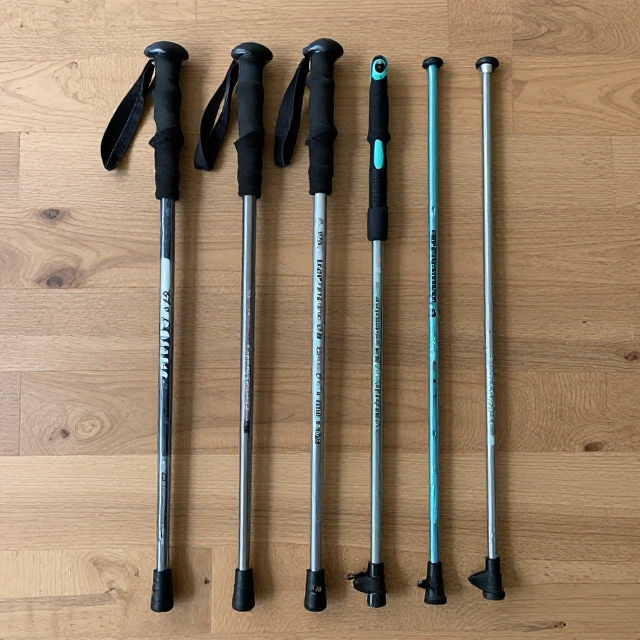
It depends on the route. Maintained winter trails may require little more than warm, waterproof clothing and suitable footwear. Snowshoe routes may require snowshoes, while icy or technical terrain can require equipment such as traction devices, crampons or other mountaineering gear.
Is winter trekking in the Alps dangerous?
Winter conditions can create hazards including avalanches, ice, extreme cold, poor visibility and rapidly changing weather. Risk varies greatly between routes. Check local conditions and avalanche information, follow official recommendations and choose a route appropriate for your experience.
What are the best countries for snowy trekking in the Alps?
The Alps span several countries, with major trekking destinations in Switzerland, Austria, France, Italy and Slovenia. Each has its own landscape and trail network, so choosing a country often comes down to the type of scenery and hiking experience you’re looking for.
Can you hike Alpine trails in winter without a guide?
Some maintained winter hiking trails can be done independently, provided conditions are suitable and you have the necessary navigation and winter skills. Remote, high-altitude or avalanche-prone routes may require substantially more expertise and, depending on the route, a qualified guide.
What should I check before a winter trek?
Check the weather forecast, snow conditions, avalanche forecast where relevant, trail closures, daylight hours and local recommendations. Also make sure you have appropriate clothing, footwear, navigation equipment, food, water and emergency supplies for the route.



Leave a Reply